If you own agricultural land or rural property in Sindh, one document defines exactly where your land sits, what shape it takes, and how it connects to surrounding plots. That document is the Shajra — the official cadastral field map of a revenue village — and knowing how to find it is not just useful, it is essential for anyone serious about protecting or transacting their land. Whether you are a buyer verifying boundaries, an heir dividing inherited property, or a landowner resolving an encroachment, this guide walks you through every step of finding your Deh Map in Sindh, both online and offline.
What Is a Shajra (Deh Map) and Why Does It Matter?
The Shajra is the cadastral map of a revenue village, known locally as a Deh or Mauza. Produced through systematic cadastral mapping — originally carried out by the Survey of Pakistan and its British-era predecessors — it is a surveyed diagram that shows every survey number within a Deh, the boundaries between plots, nearby roads, canals, and natural landmarks. Think of it as the master blueprint of all land parcels in a given revenue village.
The importance of a Shajra cannot be overstated. While a Fard tells you who legally owns a piece of land, the Shajra tells you where that land actually is on the ground. Without it, even a legitimate ownership certificate can leave you arguing over boundaries with a neighbour for years. In Sindh’s agricultural belts, where land passes through generations and boundaries shift with canal realignments, a current Shajra is the ground truth of any land claim.
The Shajra is also one of the three core components of the Record of Rights (RoR) in Sindh’s revenue system. The other two are the Jamabandi — the ownership register that records who holds each survey number — and the Khasra Girdawari — the seasonal crop and cultivation record. Together, these three documents give a complete legal and physical picture of any piece of land in the province.
Deh Map Sindh / Shajra Sindh Online
Across Sindh, land seekers and property buyers search for “Deh map Sindh,” “Shajra Sindh online,” and “how to get Shajra in Sindh.” These searches all point to the same need: finding the official cadastral map for a specific revenue village to verify physical boundaries before buying, dividing, or registering land. Understanding the administrative and technical systems behind these records — from the Board of Revenue Sindh (BOR) to the LARMIS Database — is the first step toward finding what you need quickly and correctly.
Key Terms You Need to Know Before Searching
Understanding the terminology used in Sindh’s revenue system will save you a great deal of confusion when you approach an office or search any online portal. Each term has a precise meaning that connects to a specific part of the map or record.
Deh / Mauza: The revenue village. Every Shajra belongs to one Deh. In older British-era records and in some interior districts, the same unit is referred to as a Mauza — the two terms are used interchangeably across Sindh’s land records.
Survey Number (Khasra Number): The unique identifier of each land parcel within the Deh. In Sindh it is called a Survey Number; in Punjab the equivalent is the Khasra Number. Both refer to the same concept — a uniquely numbered, mapped plot within a revenue village.
Hissa Number: The sub-division of a survey number, created when land is split between co-owners through inheritance or sale. Each Hissa represents a specific share within a parent survey number.
Khata / Khatauni: The account number assigned to a landowner or a family holding multiple survey numbers. The Khatauni groups all plots held by one household for administrative convenience and is essential when dealing with consolidated family landholdings.
Taluka: The administrative division above the Deh, equivalent to a Tehsil in Punjab. Each District is divided into multiple Talukas, and each Taluka contains many Dehs. Knowing your Taluka is required for every online and offline search.
Jamabandi: The primary ownership register forming the core of the Record of Rights. The Jamabandi records who owns each survey number, what rights exist on it, and any liabilities or encumbrances. It is the written counterpart to the Shajra’s physical map.
Record of Rights (RoR): The collective term for all formal land records in a Deh — the Shajra (map), the Jamabandi (ownership register), and the Khasra Girdawari (cultivation record). A complete due diligence check requires all three.
Shajra Nasb: The ownership lineage tree — a separate document from the field map itself but often confused with it. The Shajra Nasb traces ownership history across generations; the Shajra (Deh Map) shows physical location on the ground.
Field Book (Khasra Girdawari): The crop and cultivation register maintained season by season by the Patwari, recording what is being cultivated on each survey number. It complements the Shajra by documenting land use alongside physical boundaries.
The Administrative Hierarchy Behind the Deh Map
To navigate Sindh’s land record system efficiently, you need to understand who manages it at each level. The hierarchy runs from the province down to the individual revenue village, and knowing which official to approach — and when to escalate — saves you time and frustration.
At the top sits the Board of Revenue Sindh (BOR), the provincial authority responsible for all land records, revenue administration, and the digital infrastructure that underpins the system. The functions of the Board of Revenue include maintaining, digitizing, and making accessible all cadastral records across the province through the LARMIS system.
Below the BOR, each District is managed by a District Revenue Officer who oversees record correction, land classification, and escalated disputes. Within each District, the Taluka level is managed by the Mukhtiarkar office — a Sindh-specific revenue authority equivalent to the Tehsildar in Punjab. The Mukhtiarkar supervises all Patwari circles within the Taluka, issues certified copies of Shajra records, and is your escalation point when the Patwari is unavailable or uncooperative.
Between the Mukhtiarkar and the village-level Patwari sits the Qanungo, who supervises multiple Patwari circles and resolves disputes about map boundaries before they reach the Mukhtiarkar. The role of the Qanungo in revenue administration includes verifying Patwari records and directing corrections when errors are found in the field.
At the ground level, the Patwari is the village-level revenue official directly responsible for maintaining and presenting the Shajra to landowners on request. Understanding the duties of a Patwari in Pakistan confirms that this is not a discretionary service — it is a core official obligation that the Patwari cannot legally refuse to a legitimate landowner.
In summary, the escalation ladder from ground to district is: Patwari → Qanungo → Mukhtiarkar → District Revenue Officer. Most requests resolve at the Patwari level; a written application to the Qanungo or Mukhtiarkar handles almost every case where the Patwari proves difficult.
Where to Find Deh Maps in Sindh: Online Options
Sindh has made significant progress in digitizing its land records through LARMIS (Land Administration and Revenue Management Information System), a GIS-integrated database managed by the Board of Revenue Sindh. GIS — Geographic Information System — technology links the spatial boundaries of each survey number to its written ownership record, meaning that in fully digitized districts you can view both map boundaries and Jamabandi data from a single search. However, the availability of Shajra maps online still varies by district and Taluka.
Deh Map Sindh Online – LARMIS Portal
For online access, citizens can check the following platforms:
LARMIS Portal (sindhbor.gos.pk): The primary digital gateway for Sindh land records and the main interface into the LARMIS Database. Select your district, Taluka, and Deh, then search by survey number. Where Shajra digitization is complete, the GIS-linked map boundary data appears alongside the ownership record drawn from the Jamabandi. This is the most authoritative online source for Deh Maps in Sindh.
Sindh Land Record System — SINDHBOR Official Website: Some districts publish scanned Shajra maps as PDF files through the BOR’s official website, particularly for settlement areas where surveys were completed under older British-era systems. These scanned records are especially useful for older Dehs in districts like Hyderabad and Sukkur where physical settlement registers have been digitized but not yet fully integrated into the GIS layer.
District Revenue Offices: Each district revenue office maintains physical Shajra registers. Many have been scanned but not yet published online. Visiting or contacting the District Revenue Office directly can confirm whether a scanned copy exists for your Deh even if it is not yet accessible through the LARMIS portal.
Zameen Portal: While primarily a property listing platform, the Zameen Portal references Deh and survey number data for urban and peri-urban areas of Sindh, which can help you confirm the correct administrative identifiers — Deh name, Taluka, District — before approaching the official LARMIS portal.
Not every Deh in Sindh has a digitized Shajra available yet. Rural and interior Sindh districts, particularly Tharparkar, Badin, and parts of Jacobabad, are still being brought into the LARMIS Database as of 2025. For those areas, the physical process through the revenue hierarchy remains the only reliable option.
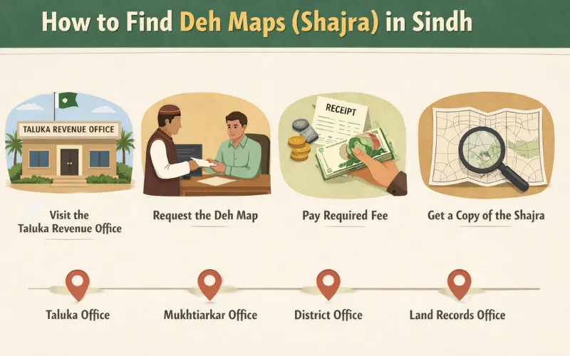
How to Get a Shajra Offline: The Physical Process Step by Step
When online access is unavailable or incomplete, the traditional route through the revenue hierarchy is your best option. This process is straightforward if you know who to approach, what to bring, and — critically — where to escalate if the first contact proves difficult.
The Patwari is the first point of contact for any Shajra-related request at the Deh level. Understanding the duties of a Patwari in Pakistan clarifies that maintaining and presenting Shajra maps to landowners on request is one of their core official responsibilities. The Patwari cannot legally refuse this to a legitimate landowner.
Here is the complete step-by-step process:
Confirm your Deh name, Taluka, and District. Every Shajra is indexed by these three identifiers. If you are unsure of the exact Deh or Mauza name, check your existing Fard, sale deed, or Jamabandi extract — all three always record the Deh name alongside the survey number and Hissa number.
Visit the Patwari Halqa office responsible for your Deh. Each Patwari circle (Halqa) covers a defined set of Dehs within a Taluka. If you do not know which Patwari covers your Deh, the Qanungo’s office or the Mukhtiarkar office can confirm it.
Provide your survey number, Hissa number, and ownership details. Bring the owner’s CNIC — or the seller’s CNIC if you are buying — alongside the most recent Fard and any sale documents referencing the survey number. If the land is held under a Khata or Khatauni number covering multiple plots, provide that as well.
Request a certified copy of the Shajra (field map) for your specific survey number. Ask explicitly for the section of the Deh Map showing your survey number and its immediate neighbours, so you can verify boundary relationships in context.
Pay the nominal fee prescribed under the Sindh Land Revenue Act. Official fees are set by the Board of Revenue Sindh. Avoid paying amounts above the prescribed rate; if an unofficial charge is demanded, escalate immediately to the Qanungo in writing.
If the Patwari is unavailable or uncooperative, escalate to the Qanungo. A written application to the Qanungo — who supervises the Patwari circle — typically resolves resistance within days. The role of the Qanungo in revenue administration includes supervising the accuracy of Patwari records and ensuring landowners receive the documents they are entitled to.
If the Qanungo does not resolve the issue, approach the Mukhtiarkar office at Taluka level. The Mukhtiarkar has authority to direct Patwari compliance, issue certified copies directly, and order field inspections. This level of escalation almost never fails to produce results, as the Mukhtiarkar holds direct supervisory power over the entire Patwari system within the Taluka.
Reading a Shajra: What the Deh Map Actually Shows
Getting the Shajra is only half the task. Knowing how to interpret it is equally important, especially if you are buying land or resolving a boundary dispute. A Deh Map uses a standardized system of lines, numbers, and symbols derived from the cadastral mapping conventions established during the original settlement surveys conducted by the Survey of Pakistan and its predecessors.
Each numbered block on the map corresponds to a survey number in the written land record — the Jamabandi. The shape of the block shows the actual dimensions and orientation of the plot. Here is what the standard map elements mean:
Thick outer lines: The Deh or Mauza boundary, separating this revenue village from the next.
Interior lines: Boundaries between individual survey numbers (Khasra Numbers) within the Deh.
Blue lines: Canals, drains, and waterways — particularly important reference points in Sindh’s irrigation-dependent agricultural belt.
Double lines: Roads and paths that also serve as natural boundaries between plots.
Hatched areas: Government or common land (Shamlat) that is not privately owned.
Numbers inside each block: The survey number (equivalent to Khasra Number in Punjab) of that plot.
Cross-referencing the Shajra with the register of rights in land revenue — the Jamabandi — gives you the complete Record of Rights picture: who owns the plot and exactly where it sits on the ground. These two documents together form the minimum verification required before any land transaction in Sindh.
Why the Shajra Is Critical Before Any Property Transaction
Many property disputes in Sindh’s agricultural districts begin with one simple failure: no one checked the Shajra before the sale. Sellers sometimes transact plots that overlap with neighbouring survey numbers, or include government canal land within the boundary of what they are selling, because the absence of map verification is never immediately obvious in the paperwork alone.
Running a Shajra check before signing any agreement is as important as verifying the Jamabandi ownership record itself. When you check land ownership in Pakistan, the Fard confirms the legal owner as recorded in the Jamabandi. The Shajra confirms the physical reality. The complete Record of Rights — Shajra, Jamabandi, and Khasra Girdawari — together gives you a complete and defensible position before any transaction.
This matters especially when dividing property among heirs, because the Shajra is used to physically demarcate which portion goes to which heir after a legal partition. Without the map, division remains a number on paper with no ground reality. Such disputes frequently end up before revenue courts in Pakistan — a process that can take years and costs far more than a Shajra verification would have.
Boundary Marks and Their Connection to the Shajra
The Shajra does not exist in isolation. It is supported on the ground by physical boundary marks — pillars or stones placed at the corners of each survey number during the original cadastral mapping and settlement survey carried out by the Survey of Pakistan or its colonial-era predecessors.
Boundary Marks and Their Connection to the Shajra in Sindh Land Record System
Boundary marks in land revenue are the physical counterparts of the lines drawn on the Shajra. If a boundary mark has been moved or destroyed, the Shajra is the authoritative document used to restore it. When someone is suspected of encroaching on your land, the Shajra combined with the original boundary marks — and, in digitized districts, the GIS data in the LARMIS Database — forms the core of your legal case before any revenue authority.
Understanding survey marks in land revenue is equally important because these marks define the geometric reference points from which all individual plot boundaries in a Deh are calculated. The GIS layer in LARMIS is anchored to these same original survey marks, which is why their preservation matters for digital record accuracy as much as for physical boundary security.
Special Cases: Agricultural Land Conversion and Shajra Updates
If agricultural land in Sindh is converted to residential or commercial use, the Shajra must be updated to reflect the changed classification — and a new cadastral survey or sub-division creating fresh Hissa numbers is often required. The original Deh Map will continue to show the land as agricultural until a formal reclassification is processed through the revenue department and the LARMIS Database is updated to reflect the change in the GIS layer.
Anyone considering converting agricultural land into a residential plot should obtain the current Shajra first to confirm the existing classification and understand what approvals are required from the Mukhtiarkar and the District Revenue Officer before any development or construction begins.
What to Do If the Shajra Has an Error
Shajra errors are more common than most people expect, particularly in older districts where British-era settlement surveys were done manually and revisions were recorded by hand before the LARMIS Database digitization began. Common errors include:
Wrong dimensions recorded for a survey number due to manual measurement error in the original settlement
A canal or road shown passing through a private plot when it does not in reality
Adjacent survey numbers shown as merged when they were never legally consolidated in the Jamabandi
Hissa boundaries not matching the actual partition on the ground as recorded in the Khatauni
GIS data in the LARMIS Database not matching a physical boundary change that was processed through paper records but never updated in the digital system
To correct a Shajra error, file a written application with the revenue officer responsible for your district. The duties of a revenue officer in Pakistan include ordering field inspections and directing Patwaris to amend records after verification. If the error is confirmed, both the physical register and the LARMIS Database record are corrected through an official amendment process. If the correction involves a dispute with another landowner, the matter is referred to a revenue court in Pakistan, which has the authority to order a fresh demarcation survey using the original Survey of Pakistan survey marks as the baseline reference.
Practical Checklist: Before You Search for a Deh Map
Having the right information ready before you approach an office or search online will save you multiple trips. Here is what to keep in hand before starting:
Full name of the Deh or Mauza (revenue village), confirmed against your existing Fard or sale documents
Name of the Taluka and District
Survey number (Khasra Number equivalent) and Hissa number, drawn from the Fard or sale deed
Khata or Khatauni number if the land is part of a multi-plot family holding
Owner’s CNIC or the seller’s CNIC if buying
A copy of the most recent Fard (ownership certificate) and a Jamabandi extract if available
Frequently Asked Questions
What is a Shajra in Sindh’s land records system?
A Shajra is the official cadastral map of a revenue village (Deh or Mauza) in Sindh. Produced through systematic cadastral mapping originally carried out by the Survey of Pakistan, it shows the boundaries of every survey number within the Deh, including roads, canals, and government land. It is maintained by the Patwari and forms part of the Record of Rights alongside the Jamabandi (ownership register) and the Khasra Girdawari (crop cultivation record). Citizens use it to verify physical land boundaries, resolve encroachment disputes, and confirm plot dimensions before any property transaction.
How can I find a Deh Map online in Sindh?
Deh Maps in Sindh can be searched through the LARMIS portal at sindhbor.gos.pk, managed by the Board of Revenue Sindh. Select your district, Taluka, and Deh, then enter the survey number. In fully digitized districts, the GIS-linked boundary data and scanned map images are available through the Sindh Land Record System. For Dehs not yet in the LARMIS Database, the physical Shajra must be obtained from the local Patwari’s office or directly from the Mukhtiarkar office at Taluka level.
What is the difference between a Survey Number and a Khasra Number?
They refer to the same concept but use different provincial terminology. In Sindh, the unique plot identifier on the cadastral map is called a Survey Number. In Punjab and Khyber Pakhtunkhwa, the equivalent is called a Khasra Number. Both are assigned during the original settlement survey and remain the primary identifier for a plot on the Shajra and in the Jamabandi.
What is the Mukhtiarkar’s role in Deh Map access?
The Mukhtiarkar is the senior revenue authority at the Taluka level in Sindh, equivalent to the Tehsildar in Punjab. The Mukhtiarkar office supervises all Patwari circles within the Taluka, issues certified copies of Shajra and Jamabandi records, and can order field inspections and direct Patwari compliance. If a landowner faces difficulty obtaining documents from the Patwari or Qanungo, a written application to the Mukhtiarkar is the appropriate escalation step before approaching the District Revenue Officer.
Is the Shajra the same as the Fard in Sindh?
No. The Fard is the ownership certificate drawn from the Jamabandi that names the legal owner of a survey number and records any liabilities or encumbrances on it. The Shajra is the cadastral map that shows where that survey number is physically located on the ground. Both are part of the Record of Rights, but they serve different purposes. A complete due diligence check requires the Fard (from the Jamabandi), the Shajra (physical location), and ideally the Khasra Girdawari (current land use) — all three together.
What should I do if my survey number boundary is incorrect on the Shajra?
If the Shajra contains an error in your survey number’s boundaries or dimensions, file a written application with the District Revenue Officer. The officer will direct the Patwari to conduct a field verification using the original Survey of Pakistan survey marks as the baseline reference. If the error is confirmed, the record is corrected through an official amendment in both the physical register and the LARMIS Database. If the correction is disputed by a neighbouring landowner, the matter goes before a revenue court for a formal demarcation survey and legal determination